The Nautical Almanac is published
“In 1767 Nevil Maskelyne's first Nautical Almanac listed where the Moon would be, so a sailor with a quadrant could read Greenwich time from the sky and find his longitude.”
A ship's latitude is easy to find from the height of the Sun or a star. Its longitude is not. A navigator needs to know the time at a fixed place, such as Greenwich, at the moment he measures local time on board: every hour of difference is 15 degrees of longitude. In the 1760s there were two ways to carry Greenwich time to sea. One was a watch that kept good time through a long voyage, still a single, costly machine. The other used the sky itself. The Moon moves across the stars about its own width, roughly half a degree, every hour, so its distance from the Sun or from a bright star works like the hand of a clock that every ship can see, provided a table says what that distance will be at Greenwich hour by hour. A sailor measured the angle with a Hadley quadrant, corrected it for the bending of light in the air (refraction) and for the Moon's nearness to the Earth (parallax), looked up the Greenwich time in the table, and compared it with local time taken from the Sun's height. This is the method of lunar distances.
The weak point was the table. In 1755 the German astronomer and mapmaker Tobias Mayer sent the British Admiralty new tables of the Moon's motion, and James Bradley, the Astronomer Royal, found that they agreed with his own observations; Mayer died in 1762. A young Cambridge clergyman and astronomer, Nevil Maskelyne, tried Mayer's tables on a voyage to St Helena in 1761, found his longitude to within about a degree and a half (dead reckoning was out by as much as ten), and set out the method in The British Mariner's Guide in 1763. But working out the Moon's place from the tables and then the distance took officers hours of hard arithmetic, up to four, they told the Board in 1765. Maskelyne's answer, partly borrowed from the French almanac the Connaissance des temps, was to have the hard sums done once, in advance, and printed every year.
On 9 February 1765 the Board of Longitude took the idea up. It resolved that Mayer's tables should be printed, that Parliament be asked to reward his widow, and for power to pay people to compile and print a Nautical Ephemeris. Maskelyne became Astronomer Royal that month, and the Longitude Act of 10 May gave the Board the legal power to publish almanacs and forbade anyone else to print them without its licence. Maskelyne then set up what was in effect a small calculating office. In June and July 1765 the Board hired four 'computers', people who calculate, at 70 pounds each to work out the tables for 1767 and 1768, and Richard Dunthorne of Cambridge as 'comparer' to check them and correct the proofs. Every article was worked by two people apart and examined by a third; for the Moon, one person worked the noon places and another the midnight places, and the results were checked by differences carried to the fourth order. The Moon's tables came from Mayer's last manuscript tables, which his widow had sent to the Board.
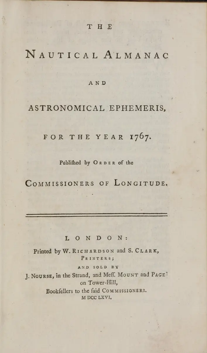
The first volume, The Nautical Almanac and Astronomical Ephemeris for the Year 1767, was licensed on 26 April 1766, finished by the end of that year, and carries the date 1766 on its title page. Maskelyne's letter of 3 January 1767 to the bookseller John Nourse shows it going on sale that month: 100 copies for immediate sale at five shillings each (four to the Board), and 55 bound handsomely for the Commissioners. Its heart is a table of the Moon's distance from the Sun and from seven bright stars near her path, given at noon and at three, six and nine hours after, beside the other data a seaman needed, and a preface and worked examples written by Maskelyne. The Board ordered 3,000 copies of each year to be printed.
Getting seamen to use it took longer than printing it. On 21 March 1767 the Board asked the Admiralty to have the Almanac circulated in the Navy's ships, and asked Nourse and his partners to send copies to the chief ports of Britain and Ireland, to New York and other places in America, and to each maritime country of Europe. In August 1768 Captain James Cook sailed in the Endeavour with the Almanacs for 1768 and 1769. On 12 November 1768 the Board asked the Admiralty to require masters of ships at Portsmouth to learn the Almanac and the quadrant, paying a guinea for each master taught, and four weeks later Robert Bishop's printed form for the arithmetic was published. The Almanac did not replace the marine watch: for decades sailors used lunars, chronometers or both, and the Almanac kept printing lunar distances into the twentieth century. Its tables were worked for the meridian of Greenwich: Cook's chart of New Zealand, made on a voyage that carried it, counts its longitude from Greenwich.
What happened
- 1765
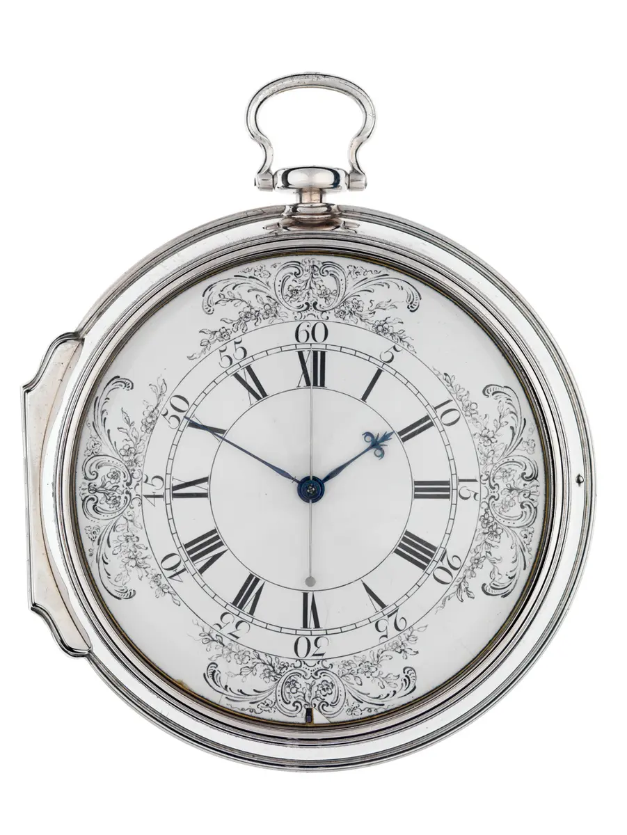
The Board of Longitude meets and hears a memorial from the Rev. Nevil Maskelyne: on his voyages to St Helena and Barbados, working from Mayer's printed tables, he had found his longitude within a degree, and Mayer's last manuscript tables should do better. Officers of East Indiamen tell the Board the same. The Board resolves that Mayer's tables should be printed, that Parliament be asked for up to 5,000 pounds for his widow, and for power to reward people to compile a Nautical Ephemeris and to print it. The same meeting passes its first judgement on Harrison's H4 (see that entry).
The Admiralty in Whitehall, where the Commissioners of Longitude metMaskelyne is appointed Astronomer Royal, in place of Nathaniel Bliss, who died in September 1764. He is the first holder of the post to be paid a proper salary, and as Astronomer Royal he is a member of the Board of Longitude. The date is the one in MacTutor and the old Dictionary of National Biography; Royal Museums Greenwich's blog gives 8 February (see QA).
The Royal Observatory, Greenwich, where Maskelyne was Astronomer Royal and the Almanac's computing was directedThe new Longitude Act becomes law. It lets the Commissioners cause nautical almanacs to be made, printed and sold, and punishes anyone else who prints them without the Commissioners' licence (20 pounds for every copy, the extract in the Almanac says).
The Board sets up the Almanac's staff. Maskelyne is to have Mayer's latest manuscript tables printed, 2,000 copies and no more, reduced to the Greenwich meridian. Israel Lyons and George Witchell are to calculate the Ephemeris for 1767, John Mapson and William Wales the one for 1768, 70 pounds each, and Maskelyne is to find someone to correct the proofs.
The Admiralty in Whitehall, where the Commissioners of Longitude metAt another meeting at the Admiralty the Board fixes the print at 3,000 copies a year, tells Maskelyne to find someone to compute the Moon's distances from the Sun and the zodiacal stars, and appoints Mr Dunthorne of Cambridge, Richard Dunthorne, 'Comparer of the Ephemerides & Corrector of the Press'. It also employs Lyons to add his own tables for refraction and parallax, to be printed at the end of the Ephemeris.
The Admiralty in Whitehall, where the Commissioners of Longitude met- 1766
The Board pays Richardson and Clark's bill for printing 2,000 sets of Mayer's tables and Maskelyne's bill for books and tables for the computers, and orders the tables published under his direction. Maskelyne fears that Witchell and Lyons, engaged for the volume for 1769, cannot finish in time without help, so they and Mapson and Wales, engaged for 1768, are to work together on both years; Dunthorne, who is to choose the stars, work out the Moon's distances, point out the eclipses and occultations, make the diagrams of Jupiter's moons and add the calendar part, is allowed 70 pounds; and the rest of the computers' money, 262 pounds 10 shillings, is paid through Maskelyne in step with their progress.
The Admiralty in Whitehall, where the Commissioners of Longitude metThe Commissioners license William Richardson and Samuel Clark of Salisbury Court to print the Almanac and its tables, and John Nourse of the Strand and Mount and Page of Tower Hill to publish and sell them, with 20 per cent allowed on the price; the warrant, signed by seventeen Commissioners, is printed in the front of every copy. Maskelyne is allowed 12 copies for his trouble.
Salisbury Court, off Fleet Street, where the printers Richardson and Clark workedThe volume for 1767 is finished. Its preface, signed by Maskelyne, says the Moon was computed from Mayer's manuscript tables and every article worked by two people and checked by a third. The title page is dated 1766.
The Royal Observatory, Greenwich, where Maskelyne was Astronomer Royal and the Almanac's computing was directed- 1767
Maskelyne sends the bookseller John Nourse the Board's licence and the plan for sale: 100 copies from the printers 'for present sale', stitched in blue paper, advertised for the day Nourse is ready to publish; 5 shillings to the buyer, 4 to the Board; and 55 copies bound handsomely for the Commissioners. The Almanac is on sale in January 1767; the day itself is not recorded.
Catherine Street at the Strand, opposite which John Nourse had his shopThe Board orders a general Table of Refraction and Parallax, first proposed by George Witchell, computed and printed (1,000 copies) under Dr Anthony Shepherd, with Mr Williams and Thomas Parkinson of Christ's College, Cambridge, as the computers. It is the table a mariner needs to correct his measured Moon distance.
Cambridge, where Dunthorne and the Cambridge professors worked on the tablesThe Board asks the Admiralty to have the Almanac and the Tables of Parallax and Refraction circulated on board the King's ships, and asks Nourse and Mount to send copies to the chief ports of Great Britain and Ireland, to New York and other places in America, and to each of the maritime countries of Europe, and to advertise them as long as they think needed.
The Admiralty in Whitehall, where the Commissioners of Longitude met- 1768
Lieutenant James Cook sails from Plymouth in the Endeavour, with Charles Green as astronomer, carrying the Nautical Almanacs for 1768 and 1769. The tables run out in 1769 and the lunars have to be worked the long way after that.
Plymouth, from where Cook's Endeavour sailed on 26 August 1768 with the Almanacs for 1768 and 1769The Board asks the Admiralty to require ships' masters at Portsmouth to learn the Almanac and Hadley's quadrant at the Royal Academy there and show a certificate, and it will pay a guinea for each master taught; Robert Bishop and Samuel Dunn are appointed to teach in London; the Royal Academy's head master is to be given an Almanac every year.
The Admiralty in Whitehall, where the Commissioners of Longitude metRobert Bishop's printed form for working out a lunar-distance observation by the Almanac is published 'according to Act of Parliament'. Maskelyne had turned to Bishop in 1768 to design the first printed forms.