The Nepal earthquake
“On 25 April 2015 a magnitude 7.8 earthquake killed nearly 9,000 people in Nepal, toppled the Dharahara tower, and was mapped from space as Kathmandu rose by about a metre.”
At 11:56 on Saturday 25 April 2015 (06:11 UTC) the ground under central Nepal broke. The US Geological Survey measured a magnitude of 7.8; Nepal's own seismic centre gave 7.6. The break began about 8 km deep under Gorkha district, near the hill village of Barpak, roughly 80 km north-west of Kathmandu, and then ran east, passing just north of the capital. Nepal's government counts a little under 9,000 dead, more than 22,000 injured and over half a million houses destroyed. A second large shock, magnitude 7.3, followed on 12 May. Eight million people, nearly a third of the country, were affected, and the government's assessment put the damage and loss at about US$7 billion, a third of a year's national income.
The cause is simple to state. The India plate is pushing north-north-east under Tibet at about 45 mm a year, and the lower, locked edge of that contact, the Main Himalayan Thrust, slips in great jerks. The last great jerk was the magnitude 8 earthquake of 1934, which killed some 10,600 people and wrecked Kathmandu; an earlier one in 1255 is said to have killed a third of the valley's people and its king. The Himalaya have long been called a seismic gap, and scientists had warned that a large earthquake was overdue. In 2015 only part of the locked zone let go: the fault did not reach the surface, so a great deal of strain is probably still stored, especially to the west.
The timing and the shaking decided who died. It was a Saturday, the weekly holiday, so schools stood empty, although nearly 7,000 were badly damaged; at night the toll would have been worse. The slip travelled east in a smooth pulse about 20 km wide, and Kathmandu sits on soft old lake sediments that ring like a bell at slow frequencies. That shaking spared many low houses but brought down taller buildings, among them the nine-storey Dharahara tower, where about 180 people died. Hundreds of temples and palaces at least a century old were destroyed or badly damaged, in the royal squares of Kathmandu, Patan and Bhaktapur among other places. The quake also set off avalanches: one hit Everest base camp and killed between 18 and 22 people; another buried the village of Langtang, where at least 200 are thought to have died.
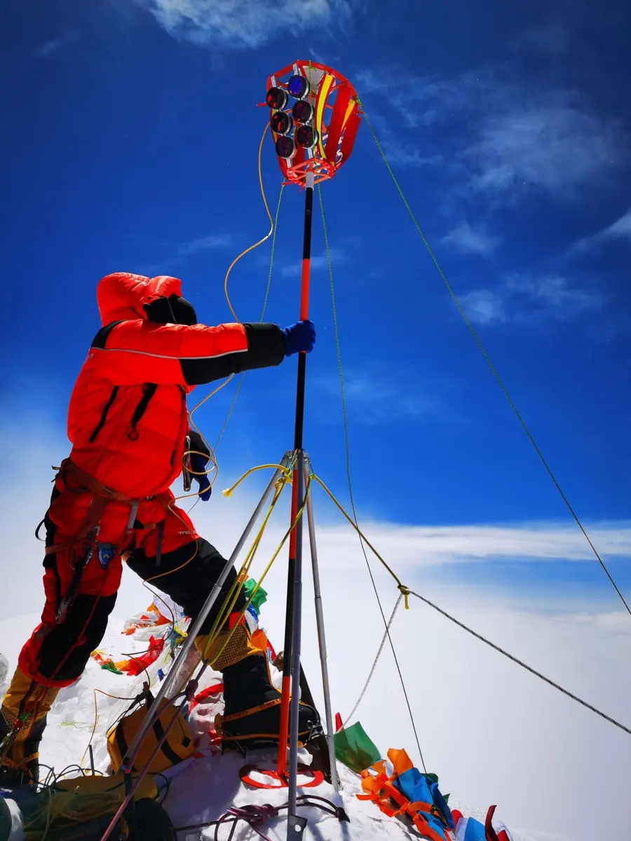
For scientists it was also a rare measured event. Radar satellites flew over before and after, and their image pairs showed in colour how far the land had moved: Kathmandu and the ground south of it rose by about a metre, while the mountains to the north sank. GPS stations, seismometers and later field work showed how the fault ruptured, and a mapping team counted 4,312 landslides triggered by the shaking. Mount Everest was moved about 3 cm to the south-west but its height did not change, as a GPS receiver installed on the mountain by Chinese scientists in 2005 showed. The question of whether the mountain had shrunk was one reason Nepal decided to remeasure it, which ended with the joint figure of 2020.
The earthquake still matters because it shows how much of a disaster is made by buildings, timing and poverty. The government's assessment found that poor rural homes without any earthquake-resistant features suffered most, and that more women and girls died than men and boys. Donors promised about US$4.4 billion at a conference in Kathmandu on 25 June 2015 against needs of US$6.7 billion, and rebuilding took years. Nobody can say the exact number of dead: the official counts run from 8,790 to 8,970 for Nepal, and the Dharahara and Everest tolls changed for weeks.
What happened
- 2015
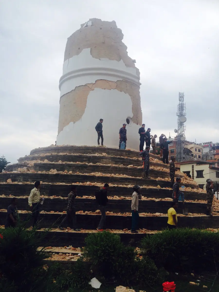
Dharahara, the nine-storey tower of 1832 in the middle of Kathmandu, falls, leaving only a stump. The USGS counts about 180 deaths at the tower; early reports gave between 150 and 250.
Dharahara (Bhimsen Tower), the 1832 tower in Kathmandu that collapsed on 25 April- 11:56 a.m.
At 11:56 Nepal time (06:11 UTC) the fault ruptures about 8 km under Gorkha district, near the village of Barpak, about 80 km north-west of Kathmandu. The rupture runs east for more than 100 km toward the capital. The USGS gives magnitude 7.8; Nepal's own seismic centre gave 7.6. It is Saturday, the weekly holiday, and the schools are shut.
Barpak, the hill village in Gorkha district nearest to the epicentre, where Nepal's seismic centre placed the 25 April main shock - 11:56 a.m.
The shaking sets off an avalanche from the ridge between Pumori and Lingtren that sweeps Everest base camp at the foot of the Khumbu icefall. The USGS reports 20 killed and 120 injured; others count 18 or 22 dead. The Everest region's villages, Namche Bazaar among them, lose houses too.
Everest base camp on the Nepal side, struck by the avalanche of 25 April - 12:54 p.m.
A magnitude 6.7 aftershock strikes near Kodari, on the Chinese border, at 12:54 Nepal time, the largest of the first two days. More than 300 aftershocks above magnitude 4 follow by 7 June. Families in Kathmandu, even those whose houses stand, sleep in the open for fear of being trapped.
Kathmandu, the capital, about 80 km south-east of the epicentre, where the ground rose by about a metre The European Space Agency publishes a Sentinel-1A radar interferogram of the quake, made from scans of 17 and 29 April. Dense colour fringes cross Kathmandu: an area about 120 x 100 km moved, half of it up and the part north of the city down. COMET scientists count about 34 fringes at 2.8 cm each, which means uplift of at least a metre only 17 km from the capital.
Kathmandu, the capital, about 80 km south-east of the epicentre, where the ground rose by about a metreRelief builds up. The UN launches a flash appeal for US$422 million. Search teams reach the hill district of Sindhupalchok: the UK's team works with sniffer dogs in the collapsed town of Chautara. In the end 134 international search teams from 34 countries and help from more than 60 countries come to Nepal.
Sindhupalchok district, where the town of Chautara is and where search teams worked from 29 AprilIn the royal squares of Kathmandu, Patan and Bhaktapur, towers and temple roofs lie in heaps of brick, while some great temples stand cracked in scaffolding. Hundreds of monuments at least a century old have been destroyed or heavily damaged across the country.
Patan Durbar Square in Lalitpur, damaged in the earthquakeA clear Landsat 8 pass shows the scar of the Langtang avalanche. A mix of snow, ice and rock has slid down and buried the village and the Langtang river; at least 200 people are thought to have died. Volunteer scientists Walter Immerzeel and Philip Kraaijenbrink are the first to identify it from the satellite data.
Langtang valley, where the village of Langtang was buried by an avalancheA week after the shock, Bhaktapur's streets are still blocked by fallen brick houses, and the old towns are counting what they have lost. Across the country the government will later list more than 600,000 private houses damaged and 280,000 more partly damaged.
Bhaktapur Durbar Square, where houses and temples fell- 12:50 p.m.
A magnitude 7.3 aftershock hits at 12:50 Nepal time, at the eastern end of the section that broke on 25 April, near the Chinese border. People run into the streets of Kathmandu again. More than 150 people die in Nepal, many in the hill districts of Dolakha and Sindhupalchok, and houses already weakened fall.
Epicentre of the magnitude 7.3 aftershock of 12 May 2015, near the Chinese border in the Dolakha-Sindhupalchok region In Barpak, the village nearest the epicentre, a soldier clears rubble by hand below the 'Welcome to Barpak Village' gate on 13 May, three weeks after the shock; piles of stone and timber fill the street. Poorer rural areas like this one suffered more than the towns, because their houses had no earthquake-resistant features.
Barpak, the hill village in Gorkha district nearest to the epicentre, where Nepal's seismic centre placed the 25 April main shockAt the International Conference on Nepal's Reconstruction in Kathmandu donors announce about US$4.4 billion in loans and grants, against the government's assessment that US$6.7 billion is needed. India's pledge of US$1 billion is the largest. Later Nepali reports revise the pledge total to about US$4.1 billion.
Kathmandu, the capital, about 80 km south-east of the epicentre, where the ground rose by about a metreAvouac and colleagues publish in Nature Geoscience that the earthquake 'unzipped' the lower edge of the locked Main Himalayan Thrust. The rupture went east from the epicentre without reaching the surface. COMET scientists say that the shallower part of the fault south of Kathmandu, and the section west of the epicentre, may still be loaded.
Kathmandu, the capital, about 80 km south-east of the epicentre, where the ground rose by about a metreGaletzka and colleagues publish in Science that the fault slipped in a smooth pulse about 20 km wide that travelled east in about 6 seconds, and that Kathmandu's basin of soft sediments rang at low frequencies. The result explains why many low houses stood while taller buildings fell.
Kathmandu, the capital, about 80 km south-east of the epicentre, where the ground rose by about a metreNASA releases a map from the landslide mapping team of the University of Arizona with NASA's JPL and Japan's ALOS-2 radar: 4,312 landslides triggered by the quake, set against the zone where the ground rose and sank. The ground-movement picture and the landslide picture are now joined.
Langtang valley, where the village of Langtang was buried by an avalanche