TOPEX/Poseidon launches to measure sea level from space
“On 10 August 1992 NASA and France's CNES launched TOPEX/Poseidon: its radar altimeters gave the first continuous global map of the sea's height and began the record of sea-level rise measured from space.”
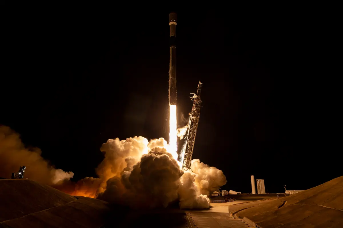
On 10 August 1992 an Ariane 42P rocket lifted off from Kourou, in French Guiana, at about 23:08 UTC (8:08 in the evening there). On top was TOPEX/Poseidon, a satellite built by NASA and France's space agency CNES to measure the height of the sea. It was put into an orbit 1,336 kilometres above the Earth, tilted 66 degrees to the equator, where one circuit takes 112 minutes and the ground track repeats exactly every 10 days. The aim, in the words of the launch brochure, was to find out how the ocean's currents shape the climate.
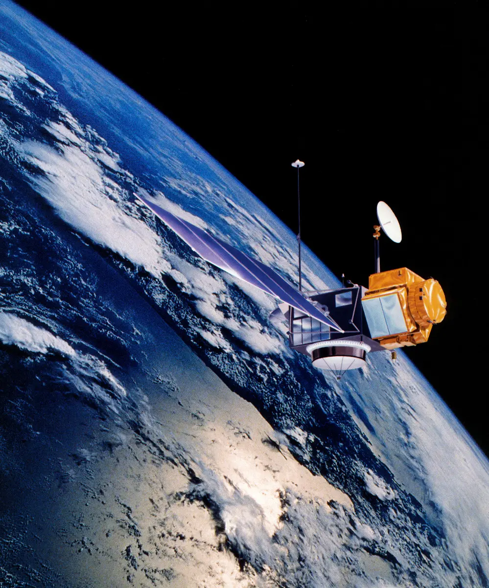
The idea is simple and the accuracy was not. A radar altimeter sends microwave pulses down at the sea and times the echo; the time gives the distance from the satellite to the surface. But to turn that into the height of the sea, the satellite's own height above the centre of the Earth has to be known to a few centimetres, and the water vapour and electrons in the air, which slow the radar pulse, have to be corrected. So TOPEX/Poseidon carried two altimeters (NASA's two-frequency one, built at Johns Hopkins, and an experimental French one, Poseidon), a microwave radiometer to measure the water vapour, and three ways of tracking itself: a laser reflector, the French DORIS system and a GPS receiver. Before launch the team hoped for a precision of 13 centimetres, and after the first years of reprocessing it announced two to three, the French agency says; NASA gives an accuracy of 4.2 centimetres.
The mission grew out of two older plans. JPL began planning TOPEX in 1979 and CNES was working on Poseidon, and neither agency could pay for a mission alone, so in 1987 they agreed to fly French and American instruments on an American satellite launched by a European rocket. Behind them lay Seasat, which flew for about three and a half months in 1978 before a short circuit ended it, and the Geosat of 1985. Lee-Lueng Fu was the NASA project scientist from 1988 until the end. The satellite was built for three to five years.
It flew for thirteen. TOPEX/Poseidon gave the first continuous, worldwide map of the shape of the sea, week after week. It watched the great 1997-98 El Niño grow and fade, from the warm water leaving Indonesia to the pool spreading up the American coast, and its data made forecasts of El Niño possible. It produced the best tide models yet made and watched the open-ocean wave of the 2004 Indian Ocean tsunami. Above all it began a record: from 1993 it measured the average height of the world's ocean to a few millimetres, year after year. Early on, the figure was about 3.8 millimetres a year, and Gary Mitchum and others used tide gauges to check that the satellite itself was not drifting. The 25-year record of T/P and its successors gives about 2.9 millimetres a year and shows the rise speeding up; NASA puts the recent rate near 4 millimetres. The oceanographer Walter Munk called it the most successful ocean experiment of all times.
TOPEX/Poseidon was joined by Jason-1 in December 2001 and for a few years the two flew side by side, checking each other. In October 2005 a reaction wheel that keeps the satellite pointing the right way stalled, and on 18 January 2006 JPL switched the satellite off with a series of commands. The same orbit and the same method were kept by Jason-1, Jason-2 (2008), Jason-3 (2016) and Sentinel-6 Michael Freilich (2020), so the sea-level record that TOPEX/Poseidon began has never been broken. SWOT, launched in 2022, is its grandchild.
What happened
- 1992
The satellite arrives at the Guiana Space Centre in Kourou, French Guiana, to be tested before launch. Five days before liftoff the encapsulated spacecraft is to be joined to the rocket.
ELA-2 launch complex, Guiana Space Centre, Kourou, French Guiana: where the Ariane 42P lifted off on 10 August 1992- 11:08 p.m.
An Ariane 42P (flight V52) lifts off from Kourou with TOPEX/Poseidon. The launch was planned for 7:08 p.m. US Eastern time, which is 23:08 UTC and 8:08 p.m. in French Guiana; the window was 44 minutes. Two small satellites share the rocket, Kitsat-1 and S80/T. The solid boosters fall away at 1 minute 28 seconds and the first stage burns out at 3 minutes 19 seconds.
ELA-2 launch complex, Guiana Space Centre, Kourou, French Guiana: where the Ariane 42P lifted off on 10 August 1992 - 11:27 p.m.
About 19 and a half minutes after liftoff (23:27 UTC on the planned timeline) the satellite separates from the third stage, in orbit at 1,336 kilometres. Its solar array opens two minutes later, the high-gain antenna after 26 and a half minutes and the GPS antenna after 27 and a half, while the stations at Bermuda and Madrid listen.
The first altimetry measurements are made, not by the big NASA altimeter but by the French Poseidon-1 prototype: the main instrument was hard to program until the satellite was in its final orbit.
Data collection begins. JPL's fact sheet gives 24 September 1992 for the end of the satellite's engineering assessment of the orbit; PO.DAAC gives 25 September as the start of data collection.
- 1993
The radar-altimeter verification phase ends. For about six months the team has checked the altimeters against the two laser-ranged calibration sites, NASA's Harvest platform off California and CNES's site near Lampedusa.
Platform Harvest off Point Conception, California: NASA's site for checking the altimeter against a laser-ranged tide gauge- 1994
CNES awards its medal to the TOPEX/Poseidon team, including Lee-Lueng Fu, Michel Lefebvre, William Patzert and Charles Yamarone. After two years the satellite has completed 9,350 orbits and 69 ten-day cycles and measures sea level to 5.7 centimetres.
- 1995
The first estimate of global sea-level change from T/P: about 3.8 millimetres a year over the first two years, after a correction for a known drift of the TOPEX altimeter. Gary Mitchum and others start to check that drift against tide gauges. The satellite also passes the end of its planned three-year life.
- 1996
After a first full reprocessing of the data the team announces a precision of two to three centimetres, against 13 centimetres expected before launch, as AVISO tells it.
- 1997
T/P sees the El Niño begin: by August 1997 the warm, high water that sat around Indonesia in December 1996 has gone, sea level there is more than 18 centimetres below normal, and Indonesia suffers drought as the warm pool and the rain move east.
T/P's map of 3 October 1997 shows El Niño's warm water spread along the whole coast of North America, from the equator to Alaska, over an area one and a half times the size of the continental United States.
The warm pool has fallen back to its early-September size after a 'double peak', in July and October, like the El Niño of 1982-83. By 10 December it grows again with wind bursts. NOAA's forecasters, using T/P data, expect a strong El Niño through the winter.
- 1999
The team switches from the TOPEX-A altimeter to the backup TOPEX-B to correct a drift in TOPEX-A. Having two equivalent instruments that ground controllers could switch between is one reason the mission lasted so long, AVISO says.
- 2001
- 3:07 p.m.
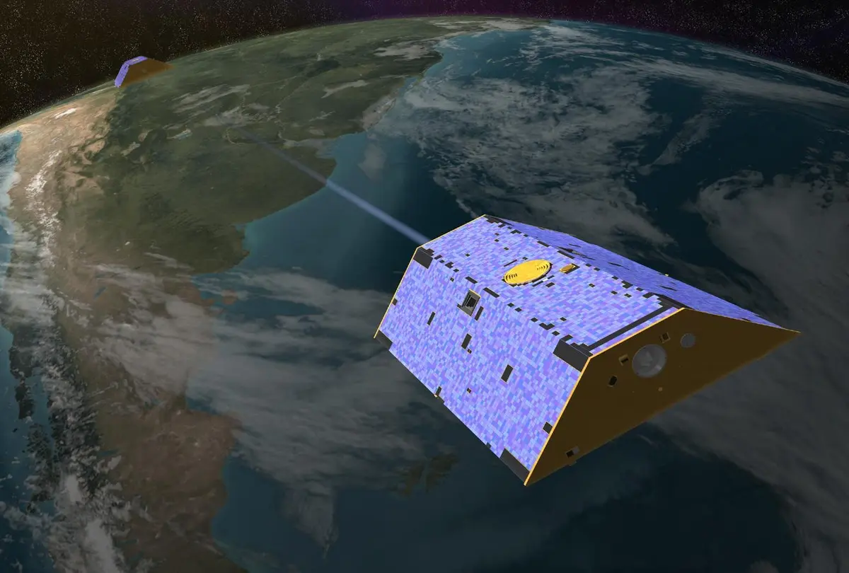
Jason-1, the follow-on to TOPEX/Poseidon, is launched by a Delta II from Vandenberg Air Force Base at 7:07 a.m. Pacific time. For months the two satellites fly one behind the other to be compared.
- 2002
Walter Munk tells the US Commission on Ocean Policy that satellites have revolutionized oceanography and that he considers TOPEX/Poseidon 'the most successful ocean experiment of all times'.
T/P starts to move to a new orbit, finished in mid-September (16 September), half-way between its old tracks, which Jason-1 keeps. The two satellites then fly the same pattern 1.4 degrees of longitude apart and check one another.
- 2004
The on-board DORIS tracking receiver fails. From now on T/P's orbit is worked out from laser ranging and altimeter crossovers.
Two hours after the Sumatra earthquake Jason-1 and TOPEX/Poseidon, about 150 kilometres apart, fly over the Bay of Bengal and record the tsunami in the open ocean as a crest about 50 centimetres high. Philip Callahan, who had searched T/P data for tsunamis since 1992, calls the catch serendipitous.
- 2005
T/P and Jason, with two other altimeters, map the warm Loop Current and an eddy in the Gulf of Mexico ahead of Hurricane Rita.
The satellite's pitch reaction wheel, which keeps it pointing the right way, stalls and ground controllers decide it no longer works. The satellite loses its ability to manoeuvre.
- 2006
NASA announces that TOPEX/Poseidon has ended after nearly 62,000 orbits. 'It became history's longest Earth-orbiting radar mission,' says Lee-Lueng Fu. It had given more than 98 percent of the data it was designed to collect, served more than 600 scientists in 54 countries and been used in over 2,100 publications, among them the most accurate global tide models.
- 5:41 p.m.
At 9:41 a.m. Pacific time (17:41 UTC) the last command files are sent from the ground: components, sensors and heaters off, the propulsion latch valves closed, two of three batteries taken out of the charge circuit and the transmitters switched off. JPL's status report counts a mission of 13 years, 5 months and one week.