The GRACE satellites start weighing the Earth's gravity
“From 2002 to 2017 the twin GRACE satellites, flying about 220 km apart, felt Earth's gravity change month by month and so tracked its ice, groundwater and sea level.”
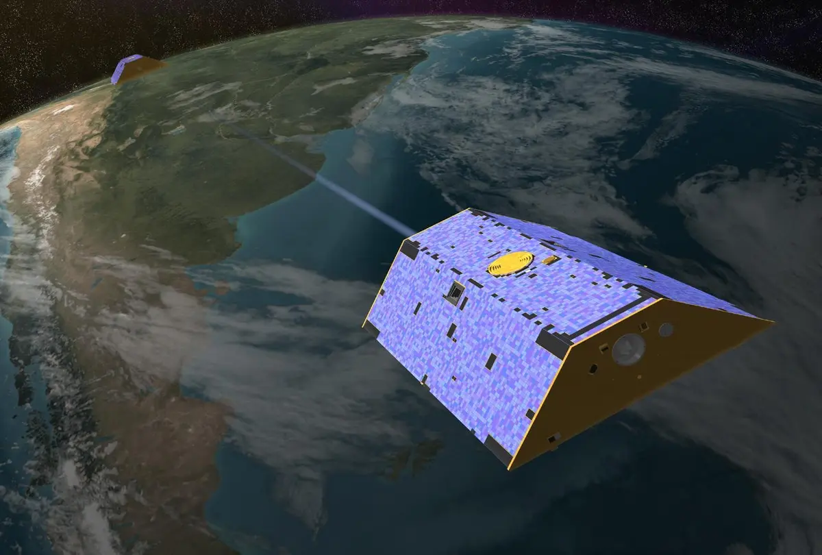
On 17 March 2002 a Russian Rockot rocket lifted two identical satellites into orbit from the Plesetsk Cosmodrome in northern Russia. Their name was GRACE, short for Gravity Recovery and Climate Experiment, and the engineers who built them called them Tom and Jerry. The mission was a partnership: NASA and the German space agency DLR ran it, the German research centre GFZ in Potsdam helped lead the science, and the Center for Space Research at the University of Texas at Austin, headed by Byron Tapley, was in charge of the science as principal investigator. The two satellites flew round the Earth from pole to pole at about 500 kilometres, one about 220 kilometres behind the other. They were planned to work for five years.
The idea is simple, and the measurement is extremely fine. Gravity pulls a little harder where there is more mass below. When the first satellite flies over a heavy region, such as a mountain range or a place with a lot of extra water, it is pulled slightly ahead, and the gap to its partner grows by a tiny amount; a little later the second satellite feels the same pull and the gap closes again. A microwave link between the two measured every change in the distance, to within a fraction of the width of a human hair across those 220 kilometres. GPS gave the timing, star cameras the direction, and an accelerometer removed the effects of air drag and sunlight. From these data the team worked out the whole gravity field of the Earth about once a month. The rock does not move, so the changes from month to month are mostly water: rain, snow, ice and groundwater moving about. In this sense GRACE weighed regions of the Earth from space.
The first results came fast. In September 2002 NASA said that 14 days of data already gave a gravity map about ten times better, for large features, than anything made before, and in July 2003 the team released its first official gravity model. Then the monthly maps began to show change. In 2006 GRACE gave the first measurement that covered the whole Antarctic ice sheet, and showed it losing mass, mostly in West Antarctica; a few months later it showed Greenland's loss speeding up. From 2002 to 2016 Greenland lost about 280 billion tonnes of ice a year and Antarctica about 125 billion, according to NASA. In 2009 GRACE showed that the groundwater under north-west India was falling fast, mainly because people were pumping it out to irrigate crops: more than 109 cubic kilometres disappeared from 2002 to 2008. In 2015 a study counted 21 of the world's 37 largest aquifers as being drained faster than they refill, and in 2018 another study traced 34 regional trends in fresh water, some caused by climate change and some by human use. GRACE can only see large areas, a few hundred kilometres across, but within those limits it made water below the ground measurable from space on a global scale.
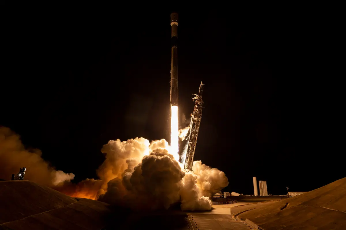
GRACE lasted three times as long as planned, but its batteries grew old; from 2010 the teams had to work around them. In September 2017 a battery cell failed on the second satellite, and on 27 October 2017 NASA, DLR and GFZ announced that the science mission was over, after more than 15 years. The last monthly map had been made in June 2017. The first satellite used its last fuel to calibrate its accelerometer and fell back into the atmosphere in March 2018. A successor, GRACE Follow-On, was built by NASA and GFZ together and launched on 22 May 2018 from California on a SpaceX Falcon 9, so the record of the planet's moving mass did not stop. GRACE is the first long run of such measurements, and users in more than 100 countries took its data.
What happened
- 2002
About 90 minutes after launch DLR's ground station at Weilheim in Bavaria makes contact with the pair, nicknamed Tom and Jerry by their builders. The satellites then begin to settle at their working distance of about 220 kilometres.
DLR ground station, Weilheim, Bavaria: made first contact with the twin satellites about 90 minutes after launch- 9:21 a.m.
A Rockot rocket lifts off from the Plesetsk Cosmodrome in northern Russia at 09:21 UTC (10:21 Central European Time) and puts the twin GRACE satellites into orbit at about 500 kilometres, in a polar orbit. The pair is run by NASA and DLR; the mission is planned for five years.
Plesetsk Cosmodrome, Launch Site 133, northern Russia: where a Rockot launched both GRACE satellites on 17 March 2002 Six months into the mission NASA reports that a first gravity map made from only 14 days of data is already about ten times more accurate, for large-scale features, than any gravity model made before GRACE. 'The mission is on track,' says principal investigator Byron Tapley.
NASA releases the first image from GRACE, showing how the distance between the two satellites changes as they pass over mountain ranges and ocean trenches. Tapley says that in 30 days GRACE has collected more information than the previous 30 years.
- 2003
The GRACE team releases its first official gravity model, GGM01, made from 111 days of early data: for large and medium features it is 10 to 50 times more accurate than all earlier Earth gravity models, with a resolution of about 200 kilometres.
Center for Space Research, University of Texas at Austin (3925 West Braker Lane): home of Byron Tapley, the principal investigator- 2005
GFZ in Potsdam publishes a new global model of the Earth's gravity field, built from CHAMP and GRACE data, and draws it as the colourful 'Potsdam Gravity Potato'.
GFZ Helmholtz Centre, Telegrafenberg, Potsdam: German partner that co-led the science and processed the data - 2006
NASA announces the first gravity survey of the whole Antarctic ice sheet, by Isabella Velicogna and John Wahr of the University of Colorado: from April 2002 to August 2005 it lost about 152 (plus or minus 80) cubic kilometres of ice a year, mostly from West Antarctica.
In Nature, Velicogna and Wahr report that Greenland's ice loss has sped up: about two and a half times as fast from April 2004 to April 2006 as in the two years before.
- 2009
NASA announces that GRACE shows the groundwater under north-west India falling by up to a foot a year, almost entirely from human use. More than 109 cubic kilometres of water disappeared from 2002 to 2008. The paper by Matt Rodell and colleagues comes out in Nature on 20 August.
At the American Geophysical Union's fall meeting Scott Luthcke of NASA Goddard presents a new map of Greenland's mass change from 2003 to 2009, made from GRACE's range data in 10-day steps.
- 2010
From about 2010 the ageing batteries and the shortage of fuel force the operations teams in the US and Germany to find ways of working around them, so that the mission can continue far beyond its planned life.
- 2015
A study using GRACE data for 2003 to 2013 finds that 21 of the world's 37 largest aquifers are being drained faster than they refill, 13 of them seriously. Jay Famiglietti of JPL and the University of California, Irvine, calls for a worldwide effort to find out how much groundwater is left.
- 2017
A battery cell fails on GRACE-2. Contact with the satellite is lost; the team later restores it and plans one last science collection for mid-October.
As the team prepares to resume science data collection it becomes clear that even in full sunlight the remaining battery capacity on GRACE-2 will not be enough to run its science instruments and transmitter.
NASA, DLR and GFZ announce that GRACE has ended its science operations after more than 15 years. GRACE-2 is decommissioned, because both satellites are needed to measure the distance between them. The monthly maps had run from April 2002 to June 2017.
Jet Propulsion Laboratory, Pasadena, California: NASA's manager of the mission- 2018
GRACE-1, which had spent its last fuel on calibration manoeuvres, re-enters the atmosphere at about 06:09 UTC and burns up.
The two GRACE Follow-On satellites stand in the clean room at Astrotech at Vandenberg Air Force Base in California, ten weeks before launch.
Space Launch Complex 4 East, Vandenberg, California: launch pad of GRACE Follow-On on 22 May 2018, and its processing siteIn Nature, NASA scientists led by Matt Rodell publish 34 regional trends in fresh water seen by GRACE from 2002 to 2016, and name their causes: climate change, natural swings and the pumping of groundwater. NASA Goddard releases the video 'For 15 Years, GRACE Tracked Freshwater Movements Around the World'.
- 7:47 p.m.
A SpaceX Falcon 9 launches GRACE Follow-On, with five Iridium NEXT satellites, from Space Launch Complex 4E at Vandenberg Air Force Base at 12:47 p.m. PDT (19:47 UTC): NASA and GFZ continue the measurements of GRACE with a new twin pair.
Space Launch Complex 4 East, Vandenberg, California: launch pad of GRACE Follow-On on 22 May 2018, and its processing site