SWOT launches to map the height of the world's water
“On 16 December 2022 NASA and France's CNES launched SWOT, the first satellite to measure the height of nearly all the water on Earth, rivers and lakes as well as the sea, in a 120 km swath.”
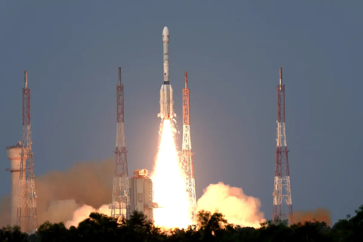
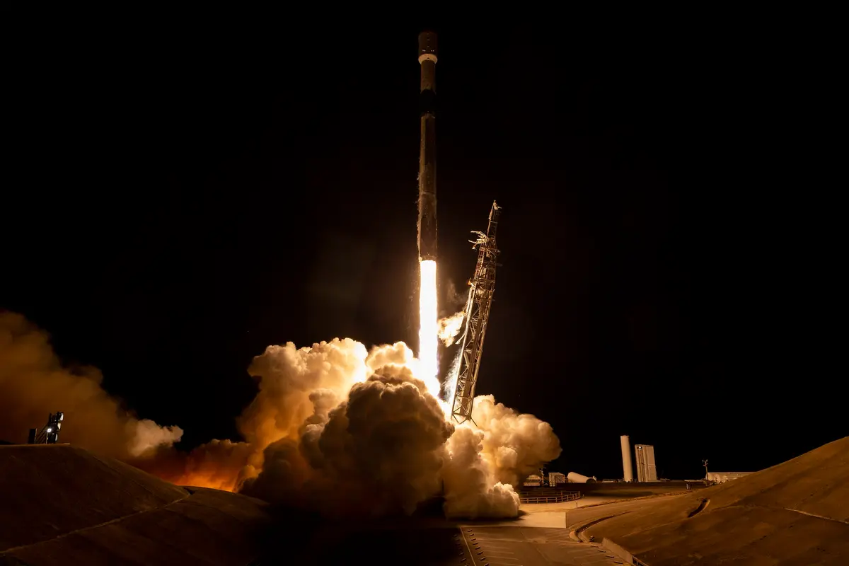
On 16 December 2022, at 3:46 in the morning Pacific time (11:46 UTC), a SpaceX Falcon 9 rocket lifted off from Space Launch Complex 4E at Vandenberg Space Force Base in California. On top of it was SWOT, the Surface Water and Ocean Topography satellite, built by NASA and the French space agency CNES, with help from the Canadian Space Agency and the UK Space Agency. Its job is to measure the height of water: the sea, but also lakes, reservoirs and rivers. NASA called it the first satellite to survey nearly all of the water on Earth's surface. It circles the planet at 891 km, in an orbit tilted 78 degrees, and looks at more than 90 percent of the globe at least once every 21 days.
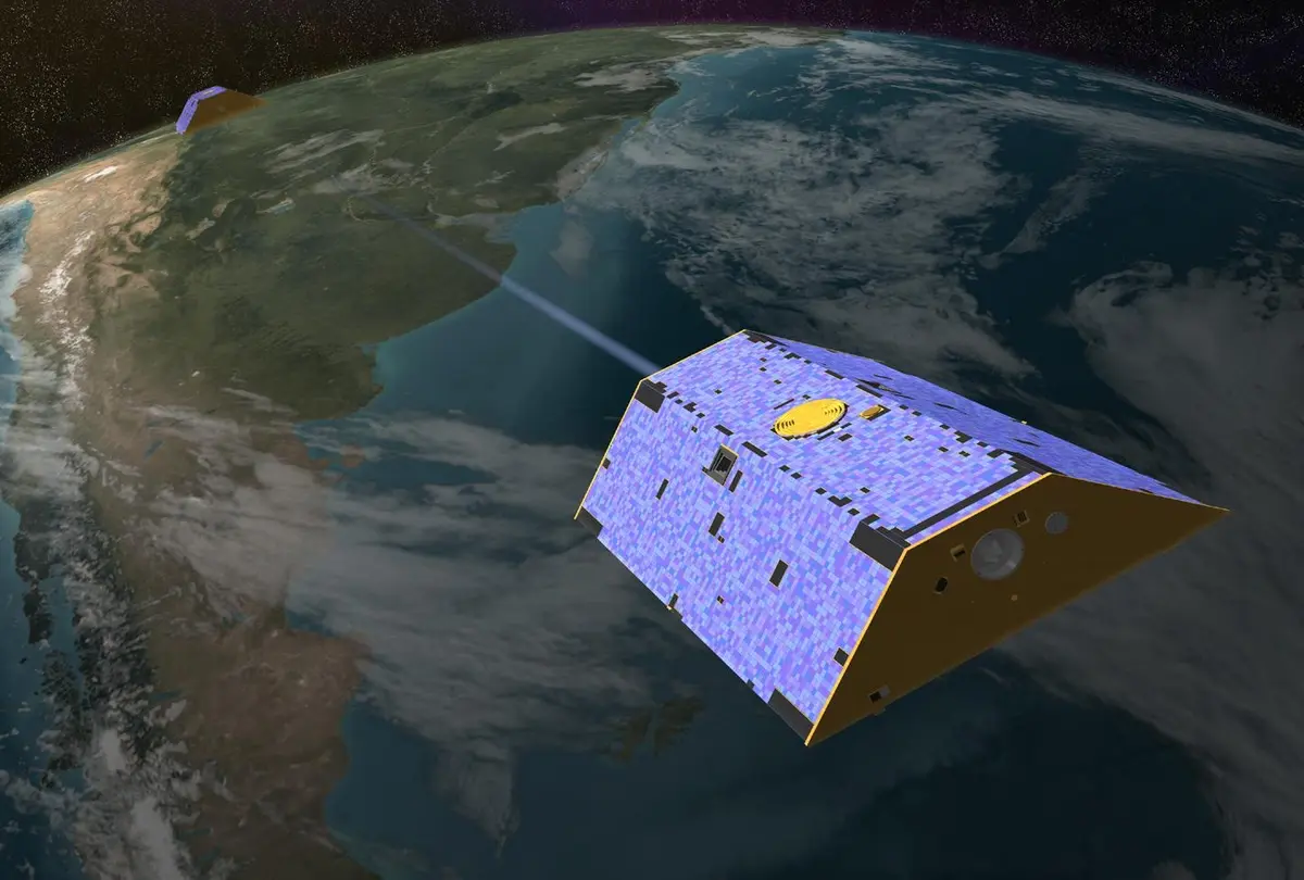
The new idea is the main instrument, KaRIn, short for Ka-band Radar Interferometer. It has two radar antennas, each 5 metres long, at the two ends of a 10-metre boom. They send microwave pulses down at the water and listen with both antennas; because the echo reaches one antenna slightly later than the other, the difference tells the height of the surface. This works like the two eyes that give us depth. Earlier radar altimeters could only measure a thin strip directly under the satellite. KaRIn looks sideways, along two swaths of 50 km, and with a strip below the satellite filled by a normal altimeter, the picture is about 120 km wide. NASA and CNES say it can follow rivers wider than 100 metres and lakes and flooded areas larger than 250 by 250 metres, and see ocean currents and eddies smaller than 20 km across.
SWOT was a long project. It was one of fifteen missions in the 2007 Decadal Survey of the US National Research Council, and CNES counts 19 September 2008 as the start of the programme. The science payload, with KaRIn, was built at NASA's Jet Propulsion Laboratory (JPL) in California; CNES provided the satellite platform, the Poseidon altimeter and the radio-frequency part of the radar, with Thales Alenia Space as its main industrial partner, and the Canadian Space Agency supplied the radar's high-power transmitter. In June 2021 a US Air Force plane carried the payload to a clean room of Thales Alenia Space near Cannes, where the whole satellite was put together. In October 2022 it flew back to California in a C-5 aircraft, landing at Vandenberg on 16 October. The launch was planned for 15 December, but moisture found in two engines of the Falcon 9 moved it by a day.
The first months were busy. About 75 minutes after launch the two solar arrays unfolded, and by 22 December the radar mast and its antennas had opened. On 21 January 2023 KaRIn gave its first data, over the Gulf Stream and Long Island, but in late January its high-power amplifier shut down by itself; the team brought it back on 9 March with a backup power unit. On 24 March NASA and CNES showed the first images. After six months of checks in a low orbit that repeats every day, the satellite climbed 33 km between 10 and 20 July 2023, and the science phase began on 26 July (CNES). The first complete 21-day map of the world's sea level was finished on 16 August, and the first KaRIn data were released to the public on 5 December 2023.
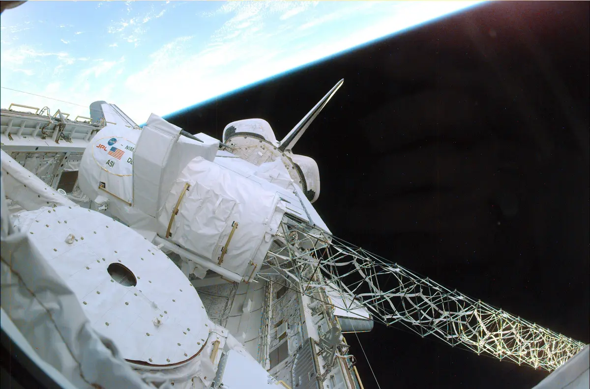
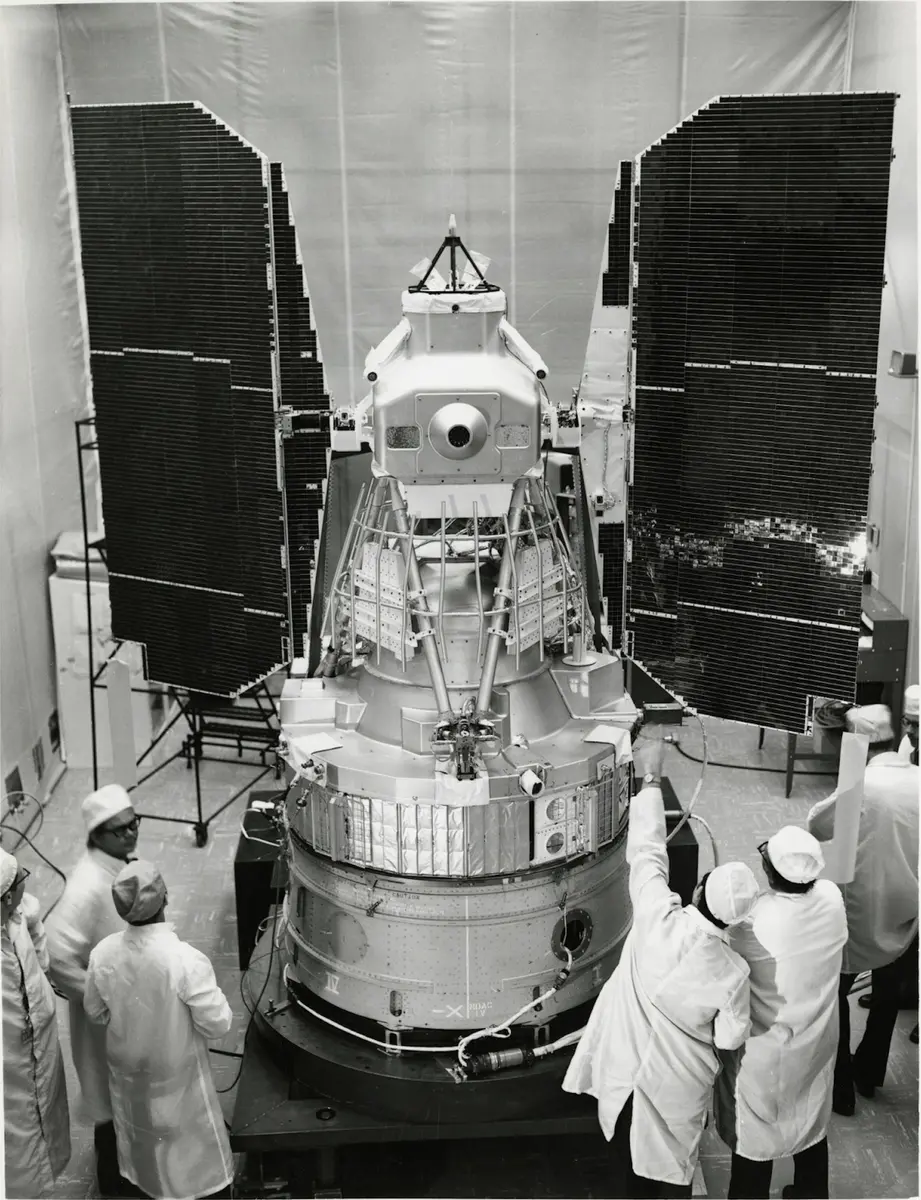
SWOT continues a line of ocean satellites. TOPEX/Poseidon, launched by NASA and CNES in 1992, showed that radar from space could measure sea level to a few centimetres; the Jason satellites (2001, 2008 and 2016) kept the record going. The Shuttle Radar Topography Mission of February 2000 showed that two radar antennas on a long mast can map height over a wide strip, and KaRIn combines the two ideas. Since then SWOT has seen a tsunami wave sloshing in a Greenland fjord in September 2023, sharper maps of seamounts on the seafloor, and the leading edge of the Pacific tsunami from the Kamchatka earthquake in July 2025, about 70 minutes after the quake. It finished its three-year prime mission in June 2026; CNES has approved an extension, and NASA's approval was expected in October 2026.
What happened
- 2021
The heart of the satellite, the science payload with the KaRIn radar and its instruments, arrives at a Thales Alenia Space clean room near Cannes, France, after a US Air Force C-17 flew it from California (it left March Air Reserve Base on 27 June). Engineers will spend the next year joining it to the satellite platform.
Thales Alenia Space, Cannes: the clean room where the payload and platform were joined in 2021-22- 2022
SWOT comes back to California aboard a US Air Force C-5 Galaxy and lands at Vandenberg Space Force Base. Teams take it to the Astrotech facility for final preparations.
Space Launch Complex 4E, Vandenberg Space Force Base, California, where SWOT lifted offIn the SpaceX facility at Vandenberg a crane lifts SWOT onto the payload adapter that will join it to the rocket.
Space Launch Complex 4E, Vandenberg Space Force Base, California, where SWOT lifted offTechnicians close the rocket's payload fairing around the satellite.
Space Launch Complex 4E, Vandenberg Space Force Base, California, where SWOT lifted offWith the Falcon 9 upright on the pad, SpaceX finds moisture in two of its first-stage engines. NASA, CNES and SpaceX move the launch from 15 to 16 December to review the data; a delta readiness review on 15 December finds the mission 'go'.
Space Launch Complex 4E, Vandenberg Space Force Base, California, where SWOT lifted offThe satellite separates from the rocket's second stage and makes contact with ground stations: first a brief partial contact from South Africa, then full contact from Sweden and Canada, which give the first reports on the spacecraft's health.
- 11:46 a.m.
SWOT lifts off on a Falcon 9 from Space Launch Complex 4E at 3:46 a.m. Pacific time (11:46 UTC). The first stage separates and returns to land at Vandenberg.
Space Launch Complex 4E, Vandenberg Space Force Base, California, where SWOT lifted off - 1:01 p.m.
At 5:01 a.m. Pacific time (13:01 UTC), 75 minutes after launch, the two solar arrays begin to unfold; the 10-minute process is filmed by two of the four cameras on board.
Space Launch Complex 4E, Vandenberg Space Force Base, California, where SWOT lifted off The radar mast and the two KaRIn antennas at its ends, 10 metres apart, finish unfolding after four days, confirmed by telemetry (the cameras did not see the last step).
- 2023
KaRIn collects its first science data over the Gulf Stream off North Carolina and Virginia, and over Long Island, New York: the 'first light' of the mission.
Long Island, New York, one of SWOT's two 'first light' scenesKaRIn, which had shut down by itself in late January when its high-power amplifier stopped, returns to commissioning, now running on a backup power unit.
NASA's Jet Propulsion Laboratory, Pasadena, which built the KaRIn radar payloadNASA and CNES show the first images from SWOT: the Gulf Stream, with ten times the detail of seven other satellites together, and the water features of Long Island.
Long Island, New York, one of SWOT's two 'first light' scenesFlying over Alaska, SWOT records the Yukon River and its lakes; NASA publishes the image on 30 August.
Yukon River, seen by SWOT over Alaska on 18 June 2023After six months in a one-day-repeat orbit at 857 km for calibration, the satellite climbs 33 km to its science orbit of 891 km in four manoeuvres of two thrusts each, flown by CNES from Toulouse; the last is on 20 July.
CNES Toulouse Space Centre, from where CNES flies the satelliteThe science phase begins, with the first 21-day cycle of global coverage, which lasts until 16 August. The date is CNES's; AVISO gives 21 July for the start of the science orbit.
CNES Toulouse Space Centre, from where CNES flies the satelliteSWOT flies over Dickson Fjord in Greenland the day after a giant rockslide set off a tsunami there, and catches the water piled up against the fjord's north wall, up to 1.2 metres higher than on the south side.
Dickson Fjord, Greenland, where SWOT saw a tsunami slosh on 17 September 2023NASA publishes the first global map of sea level from SWOT's first complete 21-day cycle.
The first KaRIn data products are released to the public through NASA's PO.DAAC and the AVISO site, with the warning that they have known limits and are meant to help users get familiar with the data.
- 2024
The SWOT Science Team officially validates the satellite's products; in October, version 2 of the products is released and a second complete reprocessing begins.
- 2025
NASA's Earth Observatory shows one of the most detailed maps yet of seamounts and abyssal hills on the ocean floor, made by a team led by Scripps Institution of Oceanography from a year of SWOT data.
SWOT passes over the Pacific about 70 minutes after the magnitude 8.8 earthquake off Kamchatka and records the leading edge of the tsunami, with waves above 0.45 metres in open water. Local date in Kamchatka (still 29 July in UTC).
Kamchatka Peninsula, Russia, where the magnitude 8.8 earthquake of July 2025 sent the tsunami SWOT recorded- 2026
SWOT completes its three-year primary mission and moves into an extended mission. CNES has approved the extension; NASA's approval is expected in October 2026.