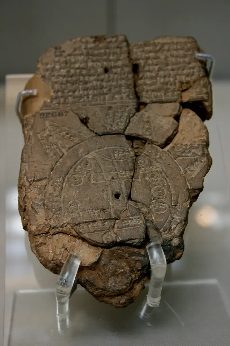
The Babylonian Map of the World
“A hand-sized clay tablet from about 600 BCE draws Babylon on the Euphrates inside a ring of ocean, with eight unknown regions beyond: the oldest known map of the world.”
About 600 BCE a Babylonian scribe drew the world on a piece of clay that fits in the palm of a hand. The tablet, now in the British Museum as BM 92687, is 12.2 cm tall and 8.2 cm wide. In the lower half of its front is a round map: two rings of water, which the labels call the Bitter River, close a disc of land. Inside it two parallel lines are the Euphrates and a rectangle across them is Babylon. Small circles stand for cities and districts, two of them named Assyria and Der, and three regions are written in: Urartu to the north, Habban, and Bit-Yakin in the south. At the bottom the river runs into the marshes and an outflow to the sea.
Outside the ocean the scribe drew eight triangles, each labelled nagu, a word for a distant region. Beside them are distances in beru, a Babylonian measure of travel, usually six or seven, and one says that the sun is not seen there. The writing on the back goes through the regions one by one; most of it is broken, and it ends that no one knows their interior. A block of text above the map lists what lives out there: ruined gods, a great serpent, a scorpion-man, the Anzu bird, wild animals made by the god Marduk, and the heroes Utnapishtim, Sargon of Akkad and Nur-Dagan. It is a picture of the real world near the middle and of myth around the edge.
Nobody knows who made it. A note at the end says it was copied from an older document. The British Museum dates the tablet to about the sixth century BCE, but because the map names Assyria, Bit-Yakin, Habban and Urartu, its curators say it cannot have been composed before the ninth. The world it shows was the Babylon of the seventh and sixth centuries: after Babylonians and Medes sacked Nineveh in 612 BCE, Babylon became the capital of the Near East, King Nebuchadnezzar rebuilt it, and the Epic of Creation made it the centre of the universe. In 539 BCE the Persians took Sippar, where the tablet would later be found, without a fight, and Babylon two days after.
The tablet lay in the mound of Abu Habba, ancient Sippar, until 1881-82, when Hormuzd Rassam dug there for the British Museum for eighteen months and took out, by his own count, sixty to seventy thousand clay tablets. The map was registered in July 1882. F. E. Peiser published it in 1889, R. C. Thompson made another copy in 1906, and Wayne Horowitz, who found both copies unreliable, published a new edition in 1988. In 1995 the curator Irving Finkel and his student Edith Horsley found a missing piece and joined it to the tablet. Finkel reads the triangle near Urartu as the place where the ark of the flood hero came to rest, the Mount Ararat of later tradition.
The museum's own curator calls it the oldest map of the world, in the world. It is not a map for travellers: its distances measure the width of the ocean, and half of it is myth. But it shows how one great civilization put itself and its neighbours on a single page and drew a line where knowledge stopped. Nothing in it was meant for a sailor or a soldier: it was made to be read and thought about.
What happened
- 600 BCE
About now a Babylonian scribe sets down the world on clay: a disc of land ringed by the 'Bitter River', with Babylon marked on the Euphrates. A note at the end says it was copied from an older document, so the picture may be older than this copy.
Babylon: the city on the Euphrates that the map draws as a rectangleBeyond the ocean the map draws eight triangular regions, called nagu, each with a distance in beru; the writing on the back describes them one by one and ends that no one knows their interior.
In the north the map places Urartu, the mountain kingdom round Lake Van, roughly where it belongs; its capital Tushpa, the rock citadel of Van, is the place on the map.
Tushpa (Van): capital of Urartu, which the map puts north of AssyriaA circle on the map is labelled Assyria, the old empire whose capital Nineveh Babylonians and Medes had sacked in 612 BCE; its oldest capital was Ashur on the Tigris.
Ashur: Assyria's oldest capital, for the circle the map labels AssyriaAt the foot of the map the river runs into marshes and an 'outflow', the real wetlands at the head of the Gulf; the land of Bit-Yakin is written above the outflow.
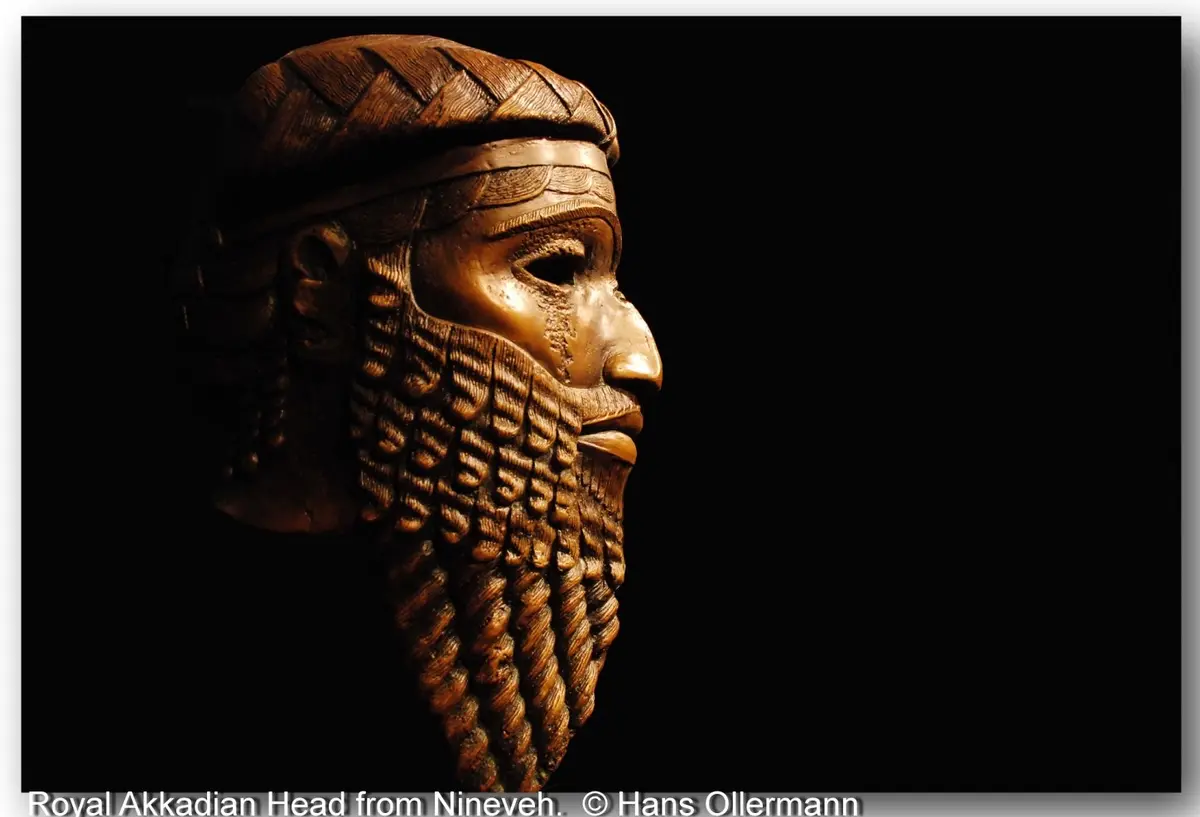
The marshes of southern Iraq: the swamp at the foot of the mapThe text above the map names three heroes: Utnapishtim, the survivor of the flood, Sargon of Akkad and Nur-Dagan of Purushanda, as if they lived in the far regions beyond the ocean.
Sargon, king of Akkad (about 2334-2279 BCE by the museum's dating), had become a legend long before the map was drawn; the tablet puts him among the beings of the outer world.
- 539 BCE
Cyrus's Persians take Sippar without a battle on the fourteenth day of the month and enter Babylon two days later: the Babylonian world the map shows comes under a new king.
Sippar (Tell Abu Habba): where Rassam's diggers found the tablet in 1881-82- 1881
Hormuzd Rassam, digging for the British Museum at Abu Habba, finds the temple of the sun-god Shamash and the stone tablet of King Nabu-apla-iddina, and so identifies the mound as ancient Sippar; he and his men go on to take out tens of thousands of clay tablets over eighteen months.
Sippar (Tell Abu Habba): where Rassam's diggers found the tablet in 1881-82 - 1882
The map tablet is registered in the British Museum as 1882,0714.509, two weeks before Rassam closes his excavations at the end of July.
The British Museum, London: home of the tablet since 1882- 1889
F. E. Peiser publishes the tablet as 'Eine babylonische Landkarte' in the Zeitschrift fuer Assyriologie, saying he found it on his last stay in London and thought the lower part was a map.
The British Museum, London: home of the tablet since 1882 - 1899
C. J. Ball prints a photograph of the tablet in Light from the East, calling it a unique document and the ocean stream's circles the 'Bitter Flood'.
- 1906
R. C. Thompson makes a second hand copy of the tablet, Cuneiform Texts XXII, 48; later scholars study the map from it.
- 1988
Wayne Horowitz, finding both old copies unreliable, publishes a new copy and edition of the tablet in Iraq, with the first photograph of its back.
- 1995
Irving Finkel and his student Edith Horsley find a missing piece of the tablet and join it to the map, restoring a triangle at the top; Channel 4 News reports it in September.
The British Museum, London: home of the tablet since 1882