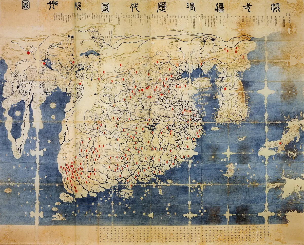
The Kangnido, Korea's map of the known world
“In 1402 Korean officials joined two Chinese maps into the oldest surviving East Asian map of the whole Old World, with Korea drawn huge and Africa and Europe from Islamic sources; only later copies survive, all in Japan.”
In the summer of 1402 a group of officials at the court of the Korean kingdom of Joseon finished a map of the whole Old World, from Japan in the east to Africa and Europe in the west. Its full name is Honil gangni yeokdae gukdo ji do, 'map of integrated lands and regions and of the capitals of past dynasties'; scholars call it the Kangnido. Two of the kingdom's highest ministers, Kim Sa-hyong and Yi Mu, ordered a junior official, Yi Hoe, to join two Chinese maps into one. The scholar Kwon Kun wrote the preface and dated it to the eighth month of that year, which fell between 19 August and 16 September. It is the oldest surviving world map of the East Asian tradition, and the oldest map of Korea that survives.
The two Chinese maps were a world map by Li Zemin, drawn under the Mongol rulers of China, and a map by the monk Qingjun that marked the capitals of every past dynasty. Li's map had little on Korea, so Yi Hoe enlarged Korea until it takes up as much room as the whole of Africa. He added Japan, drawn from a Japanese map that a Korean envoy, Pak Tonji, had been given in 1401 to 1402; Japan lies on its side, with west at the top, floating in the southern sea. China fills the middle. To the west the map shows the Arabian Peninsula, a triangle of Africa with about thirty-five names, and Europe with about a hundred. Many of these names are Chinese spellings of Persian and Arabic ones, because the Mongol empire had carried Islamic maps and geography across Asia to China.
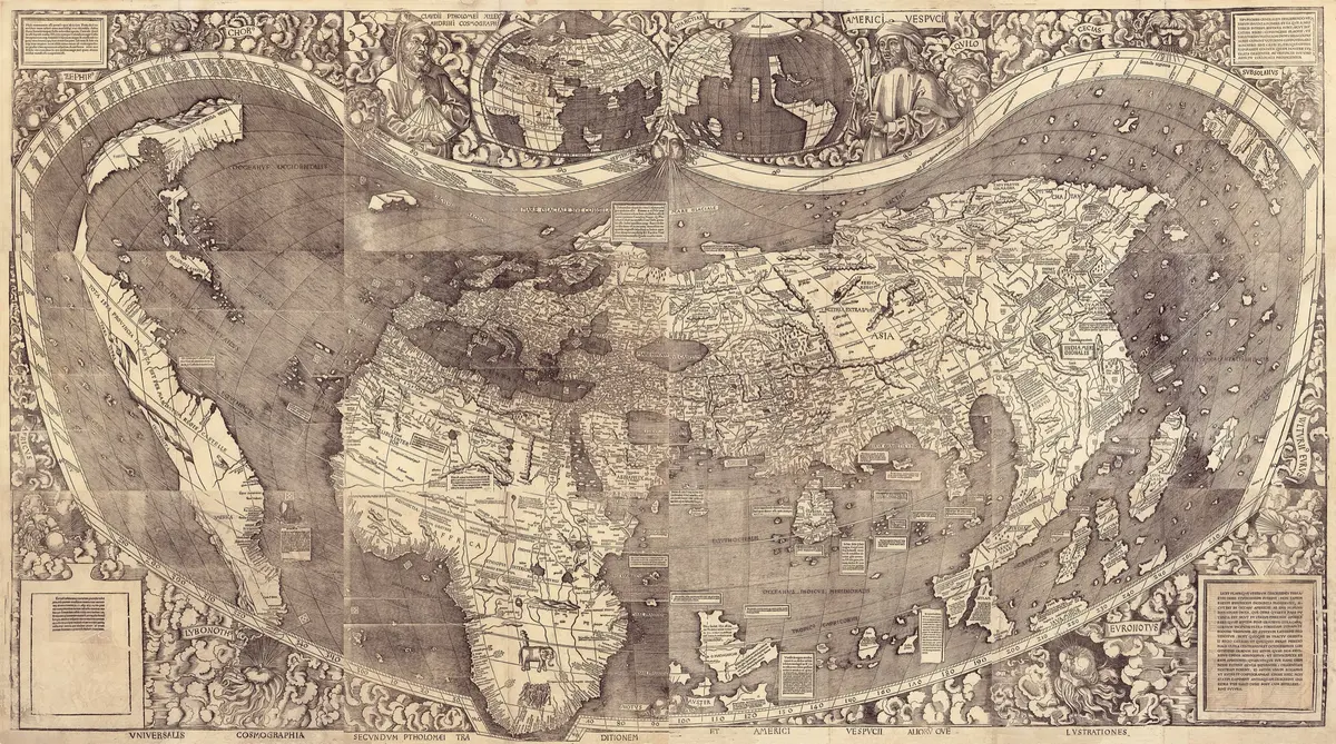
The map was a work of state, not a sailor's chart. A modern historian, Gari Ledyard, thinks it was made to hang in a palace, to show the king and his officers that Korea was a great country at the centre of a large world. It was not the first map to show three continents: the Catalan Atlas, made in Majorca in 1375, already did, and the Kangnido is much less exact about Europe. Some writers say it shows the southern tip of Africa before the Portuguese sailed there; a Silk Road scholar answers that there is little reason to think its makers knew it, even if the shape is a triangle pointing south.
The 1402 map itself is lost, and all that survives are copies made later, all of them in Japan. The oldest, on silk, was made about 1470 and is at Ryukoku University in Kyoto; a paper copy at Honkoji temple in Shimabara was revised about 1560; two related maps of China at Honmyoji in Kumamoto and in the Tenri library were copied in Korea about 1568. The Ryukoku and Honmyoji maps most likely came to Japan as loot from Hideyoshi's invasion of Korea (1592 to 1598). Scholars only noticed the Ryukoku map in 1928. The Kangnido shows what an educated Korean of 1402 knew of the world, and how much of it reached him through the Mongols.
What happened
- 1402
In the spring the ministers Kim Sa-hyong and Yi Mu report to King Taejong on the surveys of Korea's northern frontier, a few months before the world map is made; both men have handled maps for the government.
Kaesong: the old Koryo capital, where Joseon's court sat in 1402 (it moved back to Seoul in 1404-5)The envoy Pak Tonji, back from Japan, has been given a map of the country by a Japanese lord, Minamoto Mitsusuke; he adds the islands of Iki and Tsushima and doubles the scale. It becomes the Japan of the Kangnido.
The State Council gives King Taejong a map of Korea, probably the work of Yi Hoe and the map he enlarged for the world map.
Kaesong: the old Koryo capital, where Joseon's court sat in 1402 (it moved back to Seoul in 1404-5)Kwon Kun writes the preface that dates the map to the eighth lunar month, from 19 August to 16 September: Yi Hoe has joined Li Zemin's world map and Qingjun's map of the dynasties, enlarged Korea and added Japan.
- 1470
About now the map is copied with Korea's place names brought up to date; this copy, on silk, is the Ryukoku map and the last trace of the 1402 original. Nothing is known of the original after 1402.
Ryukoku University's Omiya Library, Kyoto: it holds the silk copy of about 1470 - 1560
About this time the large paper copy later kept at Honkoji is revised in Japan; its dating by Korean place names runs from 1512 to as late as 1567.
Honkoji district, Shimabara: the temple that holds the large paper copy, revised about 1560 - 1568
About now two sister maps of China, later the Honmyoji and Tenri maps, are copied in Korea from a version already far from the Ryukoku copy; they turn Japan to the north and use the Ming names for China.
Tenri Central Library, Nara: it holds the untitled sister map of about 1568 - 1592
Hideyoshi invades Korea. The Ryukoku map evidently comes to Japan as loot and is reportedly given by him to the Honganji temple in Kyoto, whose western branch is now linked with Ryukoku University.
Nishi Honganji, Kyoto: the temple to which Hideyoshi reportedly gave the Ryukoku mapDuring the same war the commander Kato Kiyomasa gives the temple of Honmyoji in Kumamoto its own paper map of the family, the 'Map of the Great Ming'.
Honmyoji, Kumamoto: the temple of Kato Kiyomasa, which holds the 'Map of the Great Ming'- 1928
The Japanese historical geographer Ogawa Takuji brings the Ryukoku map to scholars' notice, and the world learns that a Korean world map of 1402 had survived in Kyoto.
Ryukoku University's Omiya Library, Kyoto: it holds the silk copy of about 1470