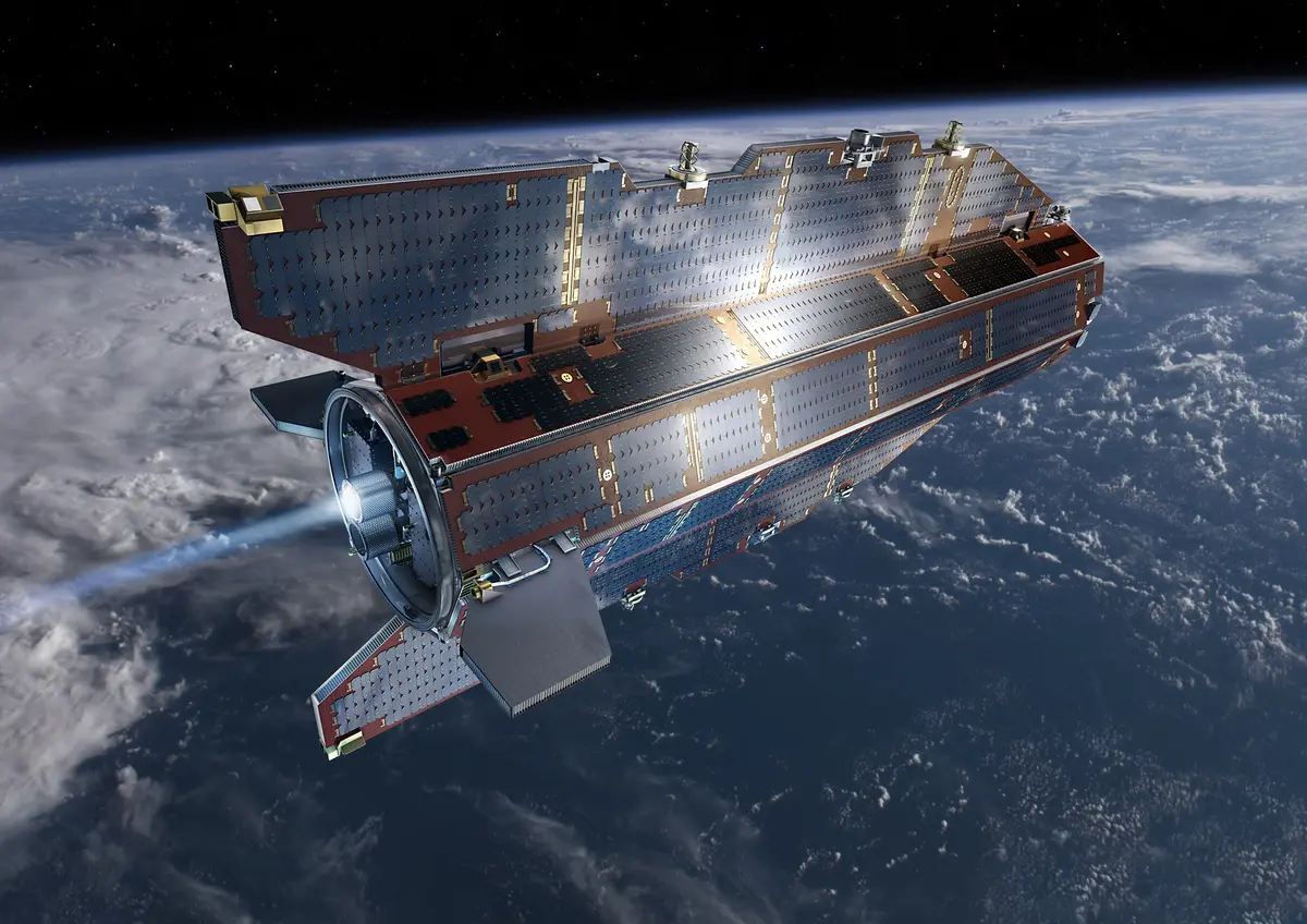
ESA's GOCE maps the gravity field from orbit
“From 2009 to 2013 ESA's ion-powered GOCE flew at about 255 km, lower than any Earth-observation satellite, and produced the most accurate map of Earth's geoid to date.”
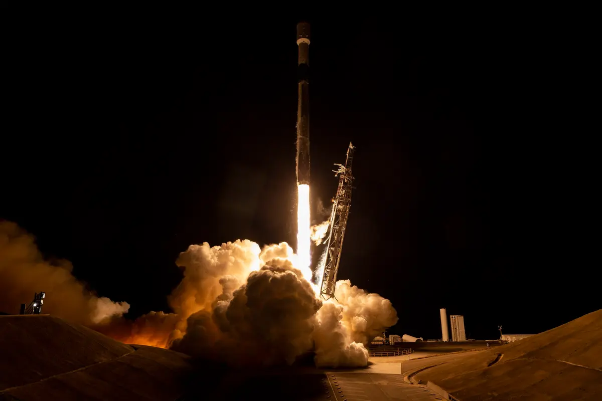
On 17 March 2009 a Russian Rockot rocket, a converted ballistic missile, lifted off from the Plesetsk Cosmodrome in northern Russia and put a slim, arrow-shaped satellite into orbit. It was GOCE, short for Gravity field and steady-state Ocean Circulation Explorer, the first of the European Space Agency's Earth Explorer core missions, chosen in 1999. The satellite was about five metres long and weighed roughly one tonne. An industrial team led by Thales Alenia Space in Italy built it, with the platform from Astrium in Germany and help from dozens of other European firms; ESA puts the cost, with the rocket and the operations, at 350 million euros. The first countdown, on 16 March, had been stopped because the doors of the launch tower would not open, a fault in a relay switch that was replaced overnight. About 90 minutes after lift-off the satellite was released at an altitude of about 280 kilometres.
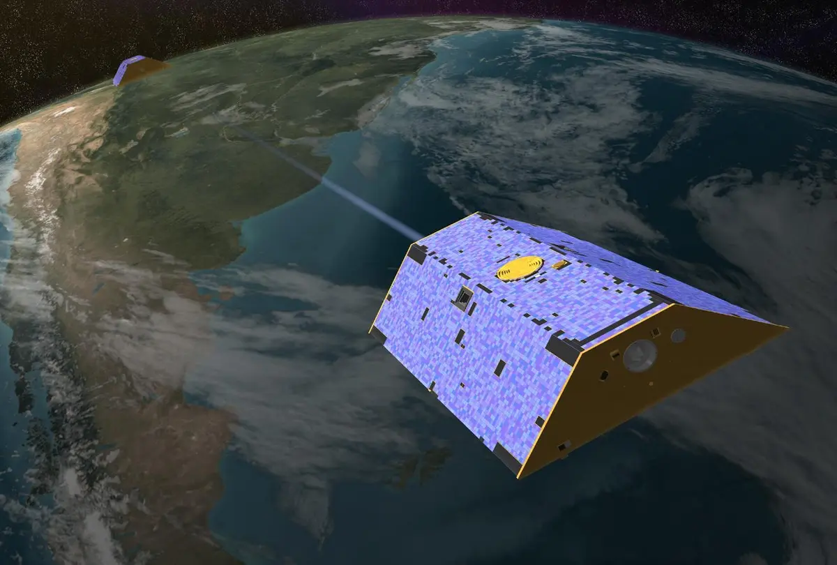
Gravity is not the same everywhere on Earth. It pulls a little harder over mountains and dense rock and a little less over ocean trenches. The geoid is the shape that an ocean would take under gravity alone, with no tides and no currents, and it is the zero line from which heights and ocean currents are measured. The gravity signal gets weaker with height, so to read its smallest differences GOCE had to fly lower than any other Earth-observation satellite, at about 255 to 260 kilometres. At that height there is still a little air, and its drag could spoil the measurement. So the satellite was given a smooth shape with two small fins, and an ion engine that pushed out charged xenon gas, with a thrust of 1 to 20 millinewtons, about the weight of a few drops of water. The main instrument, the gradiometer, felt the drag and told the engine how hard to push, so the satellite stayed in free fall. The gradiometer had six very sensitive accelerometers, in three pairs 50 centimetres apart, and it was the first of its kind in space; the small differences in pull between the two ends of each pair gave the gravity gradients.
The engine was switched on in early April 2009, the gradiometer on 8 April, and ESA reported in May that the drag control worked about ten times better than expected. The first global gravity model, made from only two months of data from late 2009, was shown by Reiner Rummel, the chairman of the mission's advisory group, at ESA's Living Planet Symposium in Bergen on 29 June 2010. In July 2010 the satellite stopped sending its science data after a fault in its main computer; engineers repaired it by software patches and by warming the computer floor by about 7 degrees, and the gradiometer was back on 6 September. The mission was then extended. On 31 March 2011, at a workshop in Munich, ESA and the Technical University of Munich unveiled what was then the most accurate model of the geoid. Later results include the first global map of the boundary between Earth's crust and mantle from gravity data (March 2012), and the discovery that the accelerometers had felt sound waves from the 2011 earthquake in Japan.
GOCE used less fuel than planned, so in 2013 ESA lowered its orbit to about 224 kilometres to measure even finer detail. On 21 October 2013 the last xenon ran out, and the mission was declared over, after nearly three times its planned life. The satellite sank for three more weeks while its instruments kept working, and on 11 November 2013, at about 00:16 UTC, it broke up over the South Atlantic near the Falkland Islands. ESA estimated that about a quarter of its 1,100 kilograms reached the surface, with no damage reported. GOCE left five gravity models, each better than the last, and a map of Earth's fixed gravity field that oceanographers, geologists and surveyors still use; it did for the steady field what the GRACE satellites, launched in 2002, did for its changes in time.
What happened
- 2009
After a first countdown on 16 March was halted when the doors of the launch tower would not open (a faulty relay switch, replaced overnight), the teams at the Plesetsk Cosmodrome prepare the Rockot for a second try, with the satellite on board.
Plesetsk Cosmodrome, northern Russia: where a Rockot launched GOCE on 17 March 2009About 90 minutes after lift-off the Breeze-KM upper stage releases GOCE in a polar orbit at about 283.5 kilometres, 1.5 kilometres lower than planned; ESA's Kiruna station in Sweden makes the first contact and control passes to ESOC in Darmstadt.
ESA's Kiruna ground station, Salmijarvi, Sweden: first contact after separation and the main link during the mission- 2:21 p.m.
A Rockot rocket lifts off from the Plesetsk Cosmodrome at 15:21:13 Central European Time and flies north over the Arctic, with the GOCE satellite as its only payload.
Plesetsk Cosmodrome, northern Russia: where a Rockot launched GOCE on 17 March 2009 - 12:00 a.m.
ESA declares GOCE ready for work at 01:00 CET, at the end of the Launch and Early Orbit Phase: the satellite is in Fine Pointing Mode and every control system works. The round-the-clock watch in ESOC's Main Control Room ends.
ESOC, ESA's European Space Operations Centre, Darmstadt, Germany: flew GOCE from separation to re-entry ESA reports that the ion propulsion system works: its B-unit was fired the week before in steps of 1, 3 and 8.3 millinewtons, its A-unit on Thursday. The satellite is at about 280 kilometres and sinking about 190 metres a day.
ESOC, ESA's European Space Operations Centre, Darmstadt, Germany: flew GOCE from separation to re-entryThe gradiometer, the first ever flown in space, is switched on. (eoPortal gives 7 April; see qa.)
ESA announces that GOCE flies drag-free: the gradiometer senses the air drag and tells the ion engine how hard to push, and first data show the compensation working about ten times better than expected.
GOCE reaches its measuring altitude of about 260 kilometres and enters measurement mode.
- 2010
A chip fault in the main computer forces the controllers to switch to the backup computer.
At ESA's Living Planet Symposium in Bergen, Norway, Reiner Rummel presents the first global gravity model from GOCE data, made from only two months of measurements (November and December 2009).
Bergen, Norway: ESA's Living Planet Symposium of 28 June to 2 July 2010, where the first global gravity model was shownGOCE suddenly stops sending its science data to the ground. The cause is almost certainly a broken communication link between the processor and the telemetry modules of the main computer.
After weeks of repair work by software patches and with the computer floor warmed by about 7 degrees, the gradiometer is switched on again and is fully functional; ESA announces the news on 7 September. The satellite is brought back down to its measuring altitude.
ESA extends the mission by 18 months, because the original period had been shortened by the faults and the satellite has fuel to spare.
- 2011
At the Fourth International GOCE User Workshop at the Technical University of Munich, ESA and the university unveil the most accurate model of the geoid produced so far, from more than 12 months of data. Rummel: 'With each new two-month cycle, our GOCE gravity field model is getting better and better.'
Technical University of Munich, Germany: Reiner Rummel's university and host of the 2011 workshop where the geoid was unveiled- 2012
ESA presents the first global high-resolution map of the Moho, the boundary between crust and mantle, calculated from GOCE's gravity data by the GEMMA project.
- 2013
Scientists report that GOCE's accelerometers felt sound waves from the great earthquake that hit Japan on 11 March 2011: the satellite had flown through the waves as they rose into the thin air at its height.
With fuel left over, ESA lowers GOCE's orbit again to about 224 kilometres (it had been lowered to 235 kilometres earlier) to measure the gravity field in still finer detail, though the drag grows.
The pressure in the xenon system drops below 2.5 bar, the level the ion engine needs; about 350 grams of xenon are left.
The last xenon is used up and ESA declares the end of the mission, nearly three times its planned life. The satellite keeps working for three more weeks while it slowly sinks.
On the afternoon, at about 133 kilometres, the gradiometer is switched off; contact with the satellite continues during the next hours.
Bill Chater, a resident of the Falkland Islands, photographs the glowing trail of the break-up at dusk (about 21:20 local time, according to ESA's caption) and posts it on Twitter.
South Atlantic east of Tierra del Fuego, south of the Falkland Islands: where GOCE broke up on 11 November 2013 (about 55.6 S, 60.2 W)- 12:16 a.m.
GOCE re-enters the atmosphere over the South Atlantic near the Falkland Islands at about 00:16 UTC (01:16 CET) and breaks up at about 80 kilometres. ESA estimates that about a quarter of its 1,100 kilograms reached the surface; no damage is reported.
South Atlantic east of Tierra del Fuego, south of the Falkland Islands: where GOCE broke up on 11 November 2013 (about 55.6 S, 60.2 W)